
Comparative lead-in: scope and stakes
This review compares high-precision multi-frequency, multi-constellation carrier phase tracking against the typical sensor suites used in track-driven remote control mowers, with practical guidance for engineers and procurement teams. I will connect positioning techniques to real deployment outcomes and reference how modern satellite services—thanks to GPS modernization and the Galileo rollout in the 2020s—changed expectations for accuracy. For immediate context on autonomy approaches, see autonomous navigation for product-level examples and integration models. This piece focuses on measurable performance, not marketing claims, and uses GNSS, RTK, and carrier phase as recurring technical anchors.
Why position accuracy matters for tracked mowers
Tracked mowers operate in confined, obstacle-rich environments: narrow alleys, steep banks, and parkland turf. Accurate pose estimation reduces boundary breaches, turf damage, and safety incidents. Carrier phase solutions (when paired with RTK) can yield centimeter-level fixes; that capability directly affects path-following and obstacle clearance. Visual systems complement GNSS by providing close-range localization—see visual navigation approaches for sensor fusion strategies—while IMU and wheel odometry fill short-term gaps during signal loss.
Technical comparison: strengths and limits
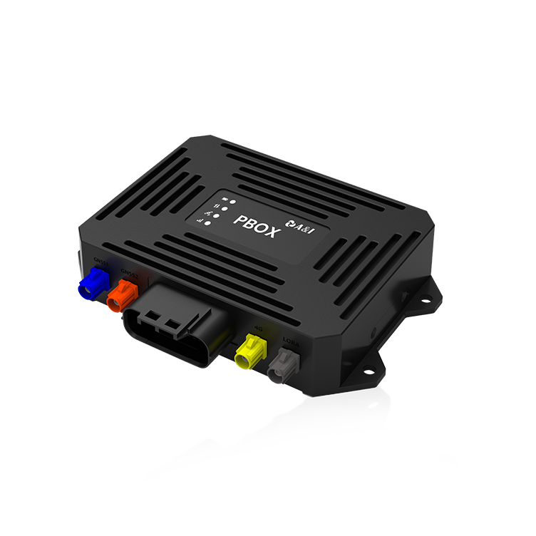
Multi-frequency, multi-constellation carrier phase tracking
– Strengths: Robust against single-constellation outages; higher resilience to ionospheric errors; superior absolute positioning when RTK corrections are available.
– Limits: Sensitivity to multipath in urban canyons and heavy foliage; needs a correction link or local base station; longer time-to-fix for integer ambiguity resolution in the presence of cycle slips.
On-board sensor suites (SLAM, IMU, wheel odometry, lidar/camera)
– Strengths: Immediate relative localization; excellent short-range obstacle detection and terrain mapping; not reliant on satellite visibility.
– Limits: Drift over time without absolute correction; computational and calibration demands; degraded performance in featureless grass or repeating patterns.
Combined approach is typically best: carrier phase for absolute georeference, SLAM and IMU for local robustness, and sensor fusion to reconcile discrepancies. This hybrid reduces single points of failure—practical deployments show fewer boundary incidents when both layers are active.
Alternatives and frequent mistakes
Many teams attempt GNSS-only solutions and underestimate multipath and antenna placement. Others overload SLAM without adequate loop closure or terrain-aware feature selection, causing drift. Common errors include poor baseline planning for RTK, neglecting antenna mast damping on tracked platforms, and skipping controlled field trials across seasonal foliage cycles. Field data consistently shows that early integration of sensor fusion reduces rework downstream.
Integration checklist and measurable tests
Define the following tests and pass thresholds before field release:
– Static uptime and time-to-fix (TTF) under canopy and open-sky: median TTF under one minute for carrier phase + RTK when corrections are available.
– Path-following cross-track error: maintain sub-0.15 m RMS for precision mowing tasks when RTK is active; accept larger bounds when only visual/odometry is available.
– Recovery resilience: ability to re-establish fix after 10 seconds of GNSS outage using IMU and SLAM for at least 30 meters without exceeding path error thresholds.
Include real-world validation in at least two contrasting environments—municipal parks and small urban courtyards—to capture multipath and terrain variability. These are repeatable, practical scenarios that mirror actual service conditions.
Three golden rules for selecting the right navigation stack
1) Prioritize hybrid architectures: choose GNSS carrier phase with RTK as the absolute layer and SLAM/IMU as the local layer; require sensor fusion middleware that exposes uncertainty metrics.
2) Demand measurable performance: contract for TTF, cross-track RMS, and outage recovery thresholds in field conditions; verify with repeated runs across foliage seasons.
3) Insist on maintainable calibration and diagnostics: accessible antenna diagnostics, IMU health monitoring, and automated bias estimation reduce downtime and warranty costs.
For teams evaluating commercial stacks, practical experience and modular testing often point to providers who balance field-proven GNSS modules with adaptable visual and inertial pipelines—this is where Archimedes Innovation typically shows value in deployments and iterative improvement.
—solid, test-driven choices keep systems predictable.